This web page contains paid links

Cruising guides - France - Atlantic coast: navigation and marinas

A guide for your cruising holiday in France (Atlantic coast)? Here are cruising guides and directions that inform you about navigation and marinas.

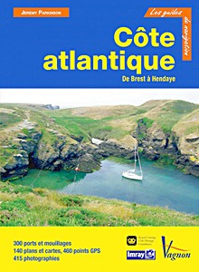
Côte Atlantique - De Brest à Hendaye

Pour chaque port, île ou baie, le lecteur trouvera une description complète et détaillée, la cartographie, les approches de jour et de nuit, les amarrages et les mouillages, les équipements et services, ou encore les visites à faire à terre.

Ce guide couvre le Finistère, la baie de Bénodet, Groix et les Rias, la Baie de Quiberon, la Vilaine et la Loire, la Vendée, la Charente, let toute la zone de la Gironde à Hendaye, avec la côte landaise, le bassin d'Arcachon et les ports du pays basque.

Les guides Imray sont l'adaptation française des ouvrages de la prestigieuse maison d'édition anglaise Imray, référence mondiale dans le domaine de la cartographie marine. Ils décrivent avec une précision inégalée les ports, les marinas, les mouillages...
Leur présentation claire, avec beaucoup de photos complétant de nombreuses cartes et plans détaillés en font des ouvrages indispensables pour des croisières réussies.

Author:Jeremy Parkinson
Specs:344 pages, 29.5 x 21.5 x 2.2 cm / 11.6 x 8.5 x 0.87 in, hardback
Illustrations:numerous colour photographs and maps
Publisher:Editions Vagnon (F, 2015)
Series:Guide Imray Vagnon
EAN:9782857259633
Côte Atlantique - De Brest à Hendaye

Côte Atlantique - De Brest à Hendaye

Language: French

Buy from Amazon.co.uk
Buy from Amazon.ca

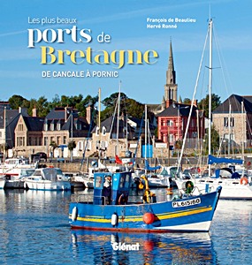
Les plus beaux ports de Bretagne - De Cancale à Pornic

Avec environ 250 ports entre Cancale et Le Croisic, la Bretagne peut se flatter de disposer de plus de la moitié des ports français sur plus de 3 000 kilomètres de côtes. On peut aussi bien s'y enchanter des ports multiples de Saint-Malo que du petit port de pêche aux crustacés de Moguériec, des gigantesques bassins à flot de La Trinité-sur-Mer que de l'étonnant amarrage sur pieux de Gwin-Zegal, des ports qui s'invitent jusqu'au centre des villes et de ceux qui s'ouvrent sur le grand large.
Derrière chaque port, il y a une histoire, un patrimoine qui s'invente, des hommes qui travaillent et d'autres qui rêvent, il y a mille émotions à partager.

Ce livre essaie de tracer le portait des plus attachants d'entre eux, en faisant la part des escales indispensables et celle de la subjectivité délibérée sans laquelle il n'y a pas de découverte possible.

Author:François de Beaulieu, Hervé Ronné
Specs:192 pages, 20 x 19 x 2 cm / 7.9 x 7.5 x 0.79 in, hardback
Illustrations:numerous colour photographs
Publisher:Glénat (F, 2013)
EAN:9782723494441
Les plus beaux ports de Bretagne - De Cancale à Pornic

Les plus beaux ports de Bretagne - De Cancale à Pornic

Language: French

Buy from Amazon.com
Buy from Amazon.co.uk

Secret Anchorages of Brittany

Secret Anchorages of Brittany provides concise pilotage directions for practically all the natural anchorages along the Brittany coast, from the Bay of Mont St Michel round to the great estuary of the Loire.
As with the first edition, the anchorages start near Cap de la Hague on the Cotentin Peninsula and include Iles Chausey. The book enters Brittany waters near Cancale and follows the whole 300-mile coastline, with its rivers, estuaries and offshore islands, looking into every nook and cranny on the way.

This stylish second edition includes many new anchorages and is lavishly illustrated in colour, while the anchorage charts have been redrawn and verified against the Admiralty or French SHOM charts.
The pilotage sections are peppered with short features on the maritime traditions, life and history of this inimitable coast. Peter Cumberlidge is a well known writer and photographer who cruises widely under sail and power. He always returns to Brittany with affection and the new Secret Anchorages reflects his sympathy for this fabulous cruising area, the people who live here and the superlative seafood for which the coast is justly renowned.

Author:Peter Cumberlidge
Specs:294 pages, 25 x 19.5 x 2.5 cm / 9.8 x 7.7 x 0.98 in, hardback
Illustrations:numerous colour photographs and maps
Publisher:Imray, Laurie, Norie & Wilson Ltd (GB, 2016)
EAN:9781846238154
Secret Anchorages of Brittany

Secret Anchorages of Brittany

Language: English

Buy from Amazon.com
Buy from Amazon.co.uk
Buy from Amazon.ca

Atlantic France - Ouessant to the Spanish Border

Covering the whole Atlantic coast of France, from Ouessant in the north to Hendaye on the Spanish border, this second edition of the RCC Pilotage Foundation's guide has been thoroughly revised and updated by Nick Chavasse who has taken his Bowman 40, Wild Bird, into every main port and a multitude of anchorages, including explorations up the numerous navigable rivers.
The plans have been revised and improved throughout and the coverage has been extended to include large scale detail for key areas including Lorient and the Gironde.

Coverage of the Brittany coast west from L''Aberwrac''h, so often the gateway to the Chenal du Four, is now extended to include the islands of Ouessant and Molène.
Many of the new photographs are on-the-water images which are invaluable to the navigator, but this edition also continues to benefit from Patrick Roach's unique and informative aerial coverage.

''Atlantic France'' is the authoritative cruising companion for this long and varied coastline with its sometimes-daunting tides and currents, and its publication has been welcomed both by first time visitors who are enjoying their first taste of the region and by old hands who are revisiting their favourite haunts.

Author:RCC Pilotage Foundation, Jeremy Parkinson
Specs:332 pages, 29.5 x 24 x 1.5 cm / 11.6 x 9 x 0.59 in, hardback
Illustrations:numerous colour photographs and maps
Publisher:Imray, Laurie, Norie & Wilson Ltd (GB, 2018)
EAN:9781846237447
Atlantic France - Ouessant to the Spanish Border

Atlantic France - Ouessant to the Spanish Border

Language: English

Buy from Amazon.com
Buy from Amazon.co.uk
Buy from Amazon.ca

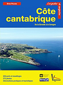
Côte Cantabrique - De la Gironde à la Corogne

Pour chaque port, île ou baie, le lecteur trouvera une description complète et détaillée, la cartographie, les approches de jour et de nuit, les amarrages et les mouillages, les équipements et services, ou encore les visites à faire à terre.
Ce guide couvre la côte Atlantique française de la Gironde à Hendaye, le Pays basque espagnol, la Cantabrie, les Asturies et la Galice jusqu'à la Corogne.

Les guides Imray sont l'adaptation française des ouvrages de la prestigieuse maison d'édition anglaise Imray, référence mondiale dans le domaine de la cartographie marine. Ils décrivent avec une précision inégalée les ports, les marinas, les mouillages...
Leur présentation claire, avec beaucoup de photos complétant de nombreuses cartes et plans détaillés en font des ouvrages indispensables pour des croisières réussies.

Author:Steve Pickard
Specs:222 pages, 29 x 22 x 1.7 cm / 11.4 x 8.7 x 0.67 in, paperback
Illustrations:numerous colour photographs and maps
Publisher:Editions Vagnon (F, 2013)
Series:Guide Imray Vagnon
EAN:9782857259848
Côte Cantabrique - De la Gironde à la Corogne

Côte Cantabrique - De la Gironde à la Corogne

Language: French

Buy from Amazon.com
Buy from Amazon.co.uk
Buy from Amazon.ca

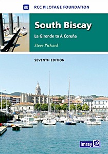
South Biscay - La Gironde to La Coruna (7th edition)

This seventh edition of the RCC's South Biscay pilot covers the coasts of France and Spain from the Gironde to La Coruna in Galicia.
This edition has been completely revised and updated. In line with other recent RCC editions, waypoints have been introduced to assist navigation.

With new photographs by the author and up-to-date aerials by Patrick Roach, South Biscay is the complete reference for yachts visiting the flay sandy coasts of southwest France and the long Biscay coast of Spain.

Author:RCC Pilotage Foundation, Steve Pickard
Specs:205 pages, 29.5 x 21.5 x 2.1 cm / 11.6 x 8.5 x 0.83 in, hardback
Illustrations:numerous colour photographs and maps
Publisher:Imray, Laurie, Norie & Wilson Ltd (GB, 2012)
EAN:9781846233753
South Biscay - La Gironde to La Coruna (7th edition)

South Biscay - La Gironde to La Coruna (7th edition)

Language: English

Buy from Amazon.com
Buy from Amazon.co.uk

Related titles:

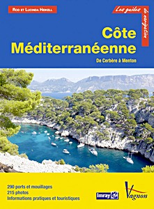
Cote Mediterraneenne - Du Cerbere a Menton

Côte Méditerranéenne - Du Cerbère à Menton

Rod Heikell, Lucinda Heikell

French | paperback | 292 p. | 2013

Corsica and North Sardinia

Corsica and North Sardinia - Including La Maddalena Archipelago

RCC Pilotage Foundation, Madeleine Strobel, Stephan Strobel

English | paperback | 2020

Corse et Sardaigne

Corse et Sardaigne - et les îles toscanes, d'Elbe à Giannutri

Rod Heikell, Lucinda Heikell

French | paperback | 276 p. | 2021

< Top >


Last update:01-09-2024