A guide for your cruising holiday on the Canal du Midi in France? Here are cruising guides and directions that inform you about navigation and marinas.
Canal du Midi : The Ultimate Guide
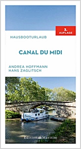
This is a must-have compact travel guide to the Canal du Midi, a picturesque waterway in Southern France, popular for boating trips and holidays. The Canal du Midi is recognised as one of the most beautiful and popular waterways in Europe. It is an Unesco world heritage site and attracts many visitors every year. It's widely regarded as the perfect boating region for wine tasting, sightseeing at medieval villages and cities, and visiting cafes and restaurants.
This up-to-date, comprehensive travel guide covers all the practical information and sightseeing opportunities boaters need to know about during their holiday on the canal, including: - Highlights and itinerary for Canal du Midi trips for easy planning - Insider travel tips for your boating holiday: where to stop off, sightseeing highlights, recommended restaurants to visit along the way - Essential practical nautical information such as how and where to charter, locks, bridges and berths and so on - Concise English-French dictionary with the most important vocab - Fantastic photography and useful route maps.
Author:
Andrea Hoffmann
Specs:
208 pages, 22 x 12.5 x 1.9 cm / 8.7 x 4.9 x 0.75 in, paperback
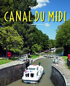
Der fast 350 Jahre alte und rund 240 Kilometer lange Canal du Midi ist eine technische Meisterleistung der Ingenieurskunst, welche ihn 1996 auf die Liste des Unesco-Weltkulturerbes brachte. Der Kanal verbindet das charmante Hafenstädtchen Sète am Mittelmeer mit Toulouse, der "rosaroten Stadt", durchkreuzt dabei die malerische Hügellandschaft der südfranzösischen Regionen Languedoc-Roussillon und Midi-Pyrénées und führt durch verschlafene Dörfer und historisch bedeutende Städte mit imposanten Bauten aus vielen Jahrhunderten.
Seit der Gütertransport auf der künstlichen Wasserstraße eingestellt wurde, erfreut sich der Canal du Midi immer größerer Beliebtheit bei Freizeitkapitänen, die mit ihren Motorbooten oder gemieteten Hausbooten in aller Ruhe auf dem Wasser dahinschippern. Auch Radfahrer und Fernwanderer haben den Kanal mittlerweile für sich entdeckt und nutzen die schattigen Treidelpfade, auf denen einst Pferde die schweren Transportkähne zogen.
Rund 180 Bilder zeigen die von Weingärten und Feldern geprägte, sanft gewellte Landschaft, beleuchten die herausragendsten technischen Bauwerke des Kanals und werfen einen Blick in die reizvollen Dörfer und Städte und hinter die dicken Mauern von Festungen, Klöstern und Kathedralen, die der Zahn der Zeit weitgehend unbeschadet gelassen hat.
The Canal du Midi is probably the most popular canal in France. Linking the Bay of Biscay with the Mediterranean, it is not only renowned for its beauty and picturesque sights, it also performs the invaluable service of saving boaters the long (and arduous) trip around Portugal and Spain to reach the Med.
This handy-sized guidebook has all the information boaters need to navigate the canal, and is packed with cruising and background information about each stage. There are enticing colour photos and distance maps of each section, showing locks, bridges and yacht havens.
This book will accompany sailors and motorboaters all the way, enabling them to make the most of their journey down one of the most famous canals in the world.
The chapters cover the following: Technical data on the waterways - Canal d'Arles a Fos-sur-Mer - Petit Rhone - Canal du Rhone a Sete - Lez - Etang de Thau - Canal du Midi - Herault - Canal de la Robine.
Specs:
144 pages, 22 x 12 x 1 cm / 8.7 x 4.7 x 0.39 in, paperback