Lorsque vous commandez via les boutons de cette page, nous pouvons percevoir une petite commission sans frais supplémentaires pour vous. En savoir plus >
Guides nautiques - Angleterre du Ouest : navigation et ports (1/2)
Une guide nautique pour votre croisière en Angleterre du Ouest ? Découvrez ici des guides pour la navigation, les ports et les attractions touristiques (1/2).
Irish Sea Pilot (Second Edition)
The Irish Sea is a huge, almost landlocked sea. Around its shores and islands there are no fewer than six countries, provinces or protectorates. Several languages are represented- English, Welsh, Irish, Scots Gaelic and Manx, along with countless accents and dialects. Its waters teem with life - dolphins and porpoises are a common sight - leatherback turtles come here from the Caribbean to feed on the jellyfish and whales are regular visitors. In the air there are gulls, puffins, guillemots and more.
The range of challenges and coastlines is astonishing. Tides above five knots are commonplace and yet there are calm, sheltered waters for relaxed wandering. This well established pilot covers both sides of the Irish Sea from Milford Haven to Portpatrick, and Rathlin Island to Carnsore Point.
From his base in Liverpool David Rainsbury spent much of 2014 revisiting the coasts he describes. The sailing directions and descriptions, updated for this second edition, cover all the places that provide shelter. At the start of each chapter there are useful coasting notes which deal with some of the more difficult passages and tidal gateways. The harbour text is then clearly organised so that essential information regarding accessibility, tides and shelter always proceed the pilotage notes which are supported by clear full colour plans. For this second edition the harbour plans have been updated and throughout new photos have been added. The text records all changes as well as including a new section on wind farms.
Caractéristiques
Auteur :
David Rainsbury
Présentation :
230 pages, 30 x 21 x 2 cm, broché
Illustration :
abondamment illustré avec des photos et des cartes et couleurs
The Solent is the spiritual home of sailing and one of Britain's most popular sailing spots, offering a varied and interesting cruising ground. In this fully updated third edition, Derek Aslett provides an authoritative companion that helps you make the most of your visit.
Centred on Cowes and covering the area from Keyhaven and Yarmouth in the west to Chichester and Bembridge in the east, the Solent Cruising Companion provides comprehensive pilotage and nautical information, as well as suggestions of where to eat and what to do ashore. The book is enhanced with colour charts and detailed photography, including spectacular aerial shots of ports, harbours and anchorages.
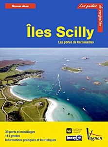
The West Country - Lyne Bay to the Isles of Scilly
An Imray cruising guide covering Lyme Bay to Land's End and the Isles of Scilly. It provides essential sailing directions and detailed listings of facilities together with a wealth of information for those wishing to learn about the West Country and enjoy trips ashore.
Part of the coastline has World Heritage Status and its geological history is described. Human settlement is traced and the reader is given guidance to find the oldest European fossil of modern man and numerous bronze age remains. Seahorses, dolphins, birds and flowers are discussed as is the history of the cream tea, which comes with a recipe for scones!
People of significance, who were born or moved here, such as Sir Francis Drake, William Cookworthy and Agatha Christie, are also included, together with information on the atmospheric railway, the mining and fishing industry and, of course, the Cornish pasty.
All the information relevant to a passage, harbour or anchorage is arranged for easy access. Aerial photographs have been taken by Patrick Roach. Ordnance Survey road maps and larger scale town plans help pinpoint facilities ashore.
Caractéristiques
Auteur :
Rojas Carlos, Susan Kemp-Wheeler
Présentation :
256 pages, 29.5 x 21 x 1 cm, broché
Illustration :
abondamment illustré avec des photos et des cartes et couleurs
Editeur :
Imray, Laurie, Norie & Wilson Ltd (GB, 2010)
ISBN:
9781846232022
The West Country - Lyne Bay to the Isles of Scilly
Bristol Channel and Severn Cruising Guide - Milford Haven to St Ives, including the Navigable Severn to Worcester
Contains all the latest information on Bristol Channel and Severn marinas, harbours and anchorages. From Milford Haven up to Lydney on the north shore and from Sharpness down to St Ives on the south shore. The pilotage is clearly charted in Imray's user-friendly style and lavish photography conveys the full atmosphere of this magnificent unspoilt cruising area.
Peter Cumberlidge has included a fascinating sequence of features on the maritime history of these waters and suggests many places of interest to visit ashore. This edition also covers the glorious inland Severn beyond Sharpness up to Gloucester, Tewkesbury, Worcester and Stourport.
Caractéristiques
Auteur :
Peter Cumberlidge
Présentation :
150 pages, 29 x 21 x 1.5 cm, broché
Illustration :
abondamment illustré avec des photos et des cartes et couleurs
Editeur :
Imray, Laurie, Norie & Wilson Ltd (GB, 2006)
ISBN:
9780852889794
Bristol Channel and Severn Cruising Guide - Milford Haven to St Ives, including the Navigable Severn to Worcester
Bristol Channel and River Severn Cruising Guide - Milford Haven to St Ives
This new edition of the Bristol Channel and Severn Cruising Guide, revised by Jane Cumberlidge, continues Peter Cumberlidge's popular classic. Covering nearly every creek, pill, river and harbour from Milford Haven in Wales to St Ives in Cornwall via Lydney and Bristol, including the fixed-mast canal route from Sharpness to Gloucester, the book reflects Peter's lifelong familiarity with these fascinating waters.
Jane has updated the sailing directions and included a lovely selection of inspiring and informative new photographs. Plans have been updated throughout. First time and return visitors alike will find this guide an essential companion when exploring this warmly welcoming and rewarding cruising ground.
Caractéristiques
Auteur :
Peter Cumberlidge, Jane Cumberlidge
Présentation :
213 pages, 29.5 x 21 x 1.5 cm, broché
Illustration :
abondamment illustré avec des photos et des cartes et couleurs
Editeur :
Imray, Laurie, Norie & Wilson Ltd (GB, 2023)
ISBN:
9781786793751
Bristol Channel and River Severn Cruising Guide - Milford Haven to St Ives
Ce site web utilise des cookies et des technologies similaires pour améliorer votre expérience de navigation sur notre site. En cliquant sur « Accepter », vous acceptez l'utilisation de ces technologies.
Cliquez sur « Refuser » pour désactiver le suivi non essentiel. Plus d'info >