Ce site web utilise des liens d'affiliation. Si vous achetez quelque chose via ces liens, nous pouvons recevoir une petite commission sans frais supplémentaires pour vous.

< Aperçu >

Guides nautiques - Angleterre - côte orientale

Une guide pour votre croisière en Angleterre (côte orientale) ? Ces livres vous informent sur la navigation, ports de plaisance et attractions touristiques.

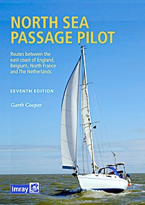
North Sea Passage Pilot - Routes between the east coast of England, Belgium, North France and The Netherlands

Readers of Imray's East Coast Pilot will need no introduction to Garth Cooper whose familiarity with North Sea passage-making is evident in the practical guidance he gives.
Under his authorship, this edition has been restructured to reflect the changing nature of passages across the North Sea. As well as a consideration of the various Traffic Separation Schemes, routes take into account the many new offshore windfarms and oil and gas extraction platforms.

As its name suggests, the emphasis of this pilot is on the passage routes, whether taking a more direct line between the UK and the Continent or incorporating hops along the East Coast and the adjacent coasts of France, Belgium and Holland.
Pilotage is included for a selection of key ports. Updated plans and numerous new photographs help to illustrate the key features to help guide you across this challenging yet rewarding stretch of water.

Auteur :Garth Cooper
Présentation :232 pages, 30 x 21 x 0.9 cm, relié
Illustration :abondamment illustré avec des photos et des cartes et couleurs
Editeur :Imray, Laurie, Norie & Wilson Ltd (GB, 2022)
Livre : North Sea Passage Pilot - Routes between the east coast of England, Belgium, North France and The Netherlands

North Sea Passage Pilot - Routes between the east coast of England, Belgium, North France and The Netherlands

Langue : anglais

Acheter sur Amazon FR
Acheter sur Amazon BE
Acheter sur Amazon CA

East Coast Pilot - Great Yarmouth to Ramsgate

East Coast Pilot has become the bible for cruising sailors for the waters between Great Yarmouth and Ramsgate. Not only does it cover the many harbours, rivers and creeks in a clear and concise manner, it also reveals some of the mysteries of sailing these shallow and shifting coastal waters.
Both authors keep their boats on the East Coast and are life-long lovers of the area. They maintain that every time they cast off and take to the water, they learn something new, adding to the considerable wealth of experience which they have passed on enthusiastically over many years.

For clarity and ease of reference the book is laid out in a logical sequence - each estuary, river and port has its own chapter which starts with the key information to get you in to that chosen destination. Box panels give key waypoints, port and harbour contact details, plus information about the main boating facilities a crew could need.
Further pages will entice you in as far as the limit of navigation. Essential information is backed up by Imray cartography, the authors' own sea-level photography giving you a clear view of what you should see, and aerial photographs which offer a useful visual perspective on what lies ahead.
Unique to East Coast Pilot are 'rolling road' diagrams to guide the approach. These were introduced to great acclaim in the first edition and show buoyage sequences and tracks to steer into rivers and ports.

Auteur :Garth Cooper, Dick Holness
Présentation :168 pages, 29.5 x 21 x 0.8 cm, broché
Illustration :abondamment illustré avec des photos et des cartes et couleurs
Editeur :Imray, Laurie, Norie & Wilson Ltd (GB, 2019)
Livre : East Coast Pilot - Great Yarmouth to Ramsgate

East Coast Pilot - Great Yarmouth to Ramsgate

Langue : anglais

Acheter sur Amazon FR
Acheter sur Amazon BE
Acheter sur Amazon CA

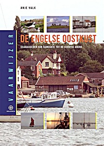
Vaarwijzer: De Engelse Oostkust - Vaargebieden van Ramsgate tot de Schotse grens

De Engelse oostkust is voor de Nederlandse watersporter 'de overkant'. Het is niet voor niets een vaak gekozen bestemming voor de voorjaarstochten van talloze watersportverenigingen. Het meest bekend is het rivierengebied van East Anglia met als bestemmingen Lowestoft, de dichtstbijzijnde Engelse haven vanuit IJmuiden, en Pinn Mill met de beroemde pub aan de Orwell.

In het gebied zijn nog veel meer mooie plekken te vinden. Anje Valk neemt de lezer mee naar de intrigerende en lastige Theemsdelta, de grotendeels droogvallende Wash en de Noord-Engelse kust tot aan de Schotse grens. Behalve voor korte oversteken leent het gebied zich ook prima voor een lange tocht tussen Ramsgate en de Schotse grens waarbij het land- en zeeschap uiteenloopt van rotsige kliffen tot droogvallende banken en 'glorious mud'.

De serie Hollandia Vaarwijzers wordt samengesteld door routiniers in het betreffende vaargebied. De auteurs willen lezers inspireren en hen daarbij alle noodzakelijke informatie geven om een tocht goed te kunnen voorbereiden. Maar uiteindelijk gaat het om de bestemming van de reis en vooral om de 'droomplekken': het perfecte aanlegplaatsje, die heerlijke haven, dat prachtige stadje en de adembenemende natuur.

Auteur :Anje Valk
Présentation :189 pages, 25 x 17.5 x 1.7 cm, relié
Illustration :abondamment illustré avec des photos et des cartes et couleurs
Editeur :Gottmer Uitgevers Groep BV (NL, 2018)
Série :Hollandia Vaarwijzer
Livre : Vaarwijzer: De Engelse Oostkust - Vaargebieden van Ramsgate tot de Schotse grens

Vaarwijzer: De Engelse Oostkust - Vaargebieden van Ramsgate tot de Schotse grens

Langue : néerlandais

Acheter sur Amazon FR
Acheter sur Amazon BE

Crossing the Thames Estuary - 60 fully explained routes and simplified passage planning tables

The Thames Estuary is a complex and challenging area with narrow channels, shoal waters, determined tides and shifting sands, plus busy shipping traffic, three major ports and six wind farms in and around it. But its waters are also fascinating, interesting and have a wide selection of destinations to enjoy.
This book describes 60 safe, viable and feasible routes between the Kent, Essex and Suffolk rivers for safe passage and wholly new time-planning tables which are now simplified with significantly additional and readily available information.

The third edition retains all the popular features describing and illustrating each sector of each route, with waypoints and 'rolling road' diagrams, providing information and advice about potential or permanent hazards, the implications for the tide and guidance about shipping routes and anchorages.

Included are new and unique passage planning tables which are simple, accurate and quick to use. Readers can select the most appropriate start time and will instantly see predicted arrival time so as to have sufficient time to continue up river to an ultimate destination.
Options are offered for every 30 minutes of the day, whatever the day. The tables not only provide the best predicted start time - for the quickest passage duration - for each route at 4, 5, 6 or 7 knots boat speed, but display alternative passage durations, whatever the tide.

Tables provide easier access and a much broader basis of information than in earlier editions, presented alongside more detailed chartlets and a new portrait format book.
Sailors benefit from swatchways in the Estuary which shorten time and distance for many passages. However, as they're liable to move or change as sands shift, the author endeavours to survey several critical swatchways, monitors and provides illustrated Notices to Mariners weekly and receives reports from readers. Any significant changes or downloads are reported by updates on the website or by email to readers on the 'Readers' Update' list.

Auteur :Roger Gaspar
Présentation :268 pages, 30 x 22.5 x 2 cm, reliure spirale
Illustration :abondamment illustré avec des photos et des cartes et couleurs
Editeur :Imray, Laurie, Norie & Wilson Ltd (GB, 2022)
Livre : Crossing the Thames Estuary - 60 fully explained routes and simplified passage planning tables

Crossing the Thames Estuary - 60 fully explained routes and simplified passage planning tables

Langue : anglais

Acheter sur Amazon FR
Acheter sur Amazon BE
Acheter sur Amazon CA

Norfolk, The Wash and Humber - Lowestoft to Spurn Head

Successor to Henry Irving's long-established guide to the nooks and crannies of this fascinating corner of the east coast of England, this new title has extended coverage under the authorship of retired harbourmaster and local cruising sailor Peter Harvey.
Some choose to bypass this beautiful section of coast and its extraordinary natural habitats, but this cruising guide gives inspiration to anyone who wishes to explore the many shallow creeks and deeper historic harbours of Norfolk, Lincolnshire and the Humber.

With thoroughly updated text and plans and new photographs throughout, The Wash and Humber remains an essential companion to this interesting and rewarding section of our coastline.

Auteur :Peter Harvey
Présentation :96 pages, 29.5 x 21 x 0.8 cm, broché
Illustration :abondamment illustré avec des photos et des cartes et couleurs
Editeur :Imray, Laurie, Norie & Wilson Ltd (GB, 2022)
Livre : Norfolk, The Wash and Humber - Lowestoft to Spurn Head

Norfolk, The Wash and Humber - Lowestoft to Spurn Head

Langue : anglais

Acheter sur Amazon FR
Acheter sur Amazon BE

Cook's Country - Spurn Head to St Abbs

A wholly original guide to the uniquely scenic and historic coasts of North Yorkshire and Northumberland. The author's fascinating personal insights complement information on all aspects of this stretch of coastline, making this an essential addition to any sailing library.

Pages du livre Cook's Country - Spurn Head to St Abbs (1)

Henry Irving has spent a lifetime sailing on the Humber and the Yorkshire coast, mostly on Venture, a Hull shrimper. He also sailed the William McCann, an old Hull steam trawler.

Auteur :Henry Irving
Présentation :50 pages, 29.5 x 21 x 0.5 cm, broché
Illustration :abondamment illustré avec des photos et des cartes et couleurs
Editeur :Imray, Laurie, Norie & Wilson Ltd (GB, 2016)
Livre : Cook's Country - Spurn Head to St Abbs

Cook's Country - Spurn Head to St Abbs

Langue : anglais

Acheter sur Amazon FR
Acheter sur Amazon BE
Acheter sur Amazon CA

Lighthouses of the East Coast - East Anglia and Lincolnshire

England's East Coast can be one of great beauty, yet in certain moods it can be treacherous and malign. Shoals and sandbanks along this coast made it dangerous for ships plying their trade both from the north east to London and across to the continent. Consequently, many innovative developments in the history of lighthouses were made here.
Find out about the lighthouse that changed Sir Peter Scott from a fowler into one of the world's leading conservationists, the lightship that was machine gunned by the Luftwaffe during World War Two, the lighthouse that became legendary amongst UFO watchers, the only lighthouse on this coast from where you can see the sunset over the sea, and the curious landlocked inland lighthouse linked to eighteenth-century sex orgies.

Everything from the medieval ecclesiastical lights illuminated in chapel windows to the state-of-the-art Trinity House head-quarters at Harwich, which today runs England's lighthouses by remote control is covered.
From Trent Falls on the Humber to the Thames Estuary and London's East End, this is a definitive guide to the lighthouses and primary lightships of the coast of Lincolnshire and East Anglia and the amazing stories behind them. Heavily illustrated, it is a fascinating guide which can be enjoyed on the ground - or in the comfort of the armchair!

Auteur :Robin Jones
Présentation :144 pages, 22 x 23.5 x 1.9 cm, relié
Illustration :abondamment illustré avec des photos en N&B et couleurs
Editeur :Halsgrove (GB, 2013)
Livre : Lighthouses of the East Coast - East Anglia and Lincolnshire

Lighthouses of the East Coast - East Anglia and Lincolnshire

Langue : anglais

Acheter sur Amazon FR
Acheter sur Amazon BE
Acheter sur Amazon CA

Autres livres dans cette catégorie :

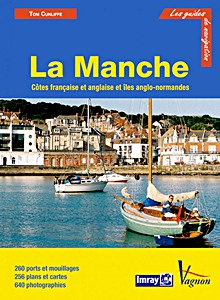
La Manche

La Manche - Côtes française et anglaise et îles anglo-normandes et

Tom Cunliffe

français | broché | 422 p. | 2014

Channel Waypoint Guide

Channel Waypoint Guide

Peter Cumberlidge

anglais | broché | 156 p. | 2012

Channel Islands, Cherbourg Peninsula, North Brittany

Channel Islands, Cherbourg Peninsula, North Brittany

RCC Pilotage Foundation, Peter Carnegie

anglais | relié | 2018

Imray Chart C10: Western English Channel

Imray Chart C10 : Western English Channel

Imray

anglais | carte (pliée) | 1 p. | 2018

Imray Chart C12: Eastern English Channel

Imray Chart C12 : Eastern English Channel

Imray

anglais | carte (pliée) | 1 p. | 2018

< Retour en haut >


Dernière actualisation :15-04-2024