Menú

Este sitio web utiliza enlaces de afiliados. Cuando usted compra algo a través de estos enlaces, podemos ganar una pequeña comisión sin coste adicional para usted. Más información

< Resumen >

Guías de navegación - Alemania: navegación y puertos

¿Una guía para su crucero por Alemania? Estas guías náuticas le informarán sobre navegación, marinas y lugares de interés en Alemania.

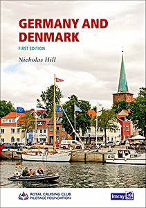
Germany and Denmark

This new Royal Cruising Club Pilotage Foundation title is the successor to Brian Navin's cruising guide to the area, covering the exposed North Sea coasts and the more protected Baltic Sea coasts of both Germany and Denmark.
Coverage has been updated and expanded from specific routes to a comprehensive sequence of ports and anchorages along each area of coast, with introductory information about places of interest to visit ashore.

Author Nicholas Hill cruised the region extensively for many years and has enriched the text with new photographs throughout. Plans include up to date hydrographic data for both German and Danish waters.
This cruising guide is an ideal companion for those who plan to explore the more challenging, shifting coastline of the North Sea and the comparatively gentle and intricate indentations and archipelagos in the entrance to the Baltic. It is also a useful resource for anyone on a more direct passage through to the Baltic Sea proper.

Autor:RCC Pilotage Foundation, Nicholas Hill
Presentación:272 páginas, 29.5 x 21 x 1.7 cm, tapa blanda
Ilustración:abundantemente ilustrado con fotos a color y mapas
Editor:Imray, Laurie, Norie & Wilson Ltd (GB, 2022)
Livre: Germany and Denmark

Germany and Denmark

Idioma: Inglés

Comprar en Amazon ES
Comprar en Amazon.com
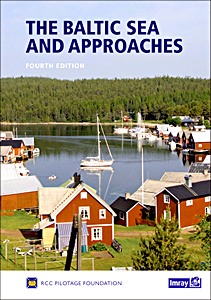
The Baltic Sea and Approaches (4th Edition)

This 4th edition has been produced by a team from the Royal Cruising Club and contains substantial changes. Apart from the routine updating of the text and plans - many newly drawn for this edition - and the addition of new photos, there are also some major changes.
In particular coverage of Finland has been reorganized, and reflecting the fast pace of change since the last edition, the Baltic States and Poland sections have been improved significantly.

The nine countries bordering the Baltic Sea offer an immense variety of cruising grounds, people and cultures. There are thousands of harbours and innumerable anchorages, and it would take an entire bookshelf, to cover them all in detail. The information contained in this book is therefore selective.

It has been chosen for its value both at the planning stages - preparing the yacht, choosing the most suitable route, timing and communications etc - and again on arrival, when a general overview of each individual country is followed by specific harbour information.
Where detailed cruising information is readily available - effectively Germany, Denmark, Sweden and Finland - only selected harbours are covered, chosen, with a few exceptions, as fulfilling certain key needs.
Where cruising information is more limited - Poland, Kaliningrad, Lithuania, Latvia, Estonia and Russia - many smaller harbours are also featured in detail.

In addition to comprehensive suggestions for further reading (and sources in each country from which they may be ordered) more than 200 websites are listed, again chosen for their relevance both at the planning stages and en route.
In order to facilitate the latter, as well as for general communication, details of internet access points are included for most major harbours. Beautiful, secluded anchorages, picturesque canals, bustling marinas, dramatic cities - all await those considering a Baltic cruise.

Autor:RCC Pilotage Foundation
Presentación:376 páginas, 29.5 x 21 x 4 cm, tapa dura
Ilustración:abundantemente ilustrado con fotos a color y mapas
Editor:Imray, Laurie, Norie & Wilson Ltd (GB, 2017)
Livre: The Baltic Sea and Approaches (4th Edition)

The Baltic Sea and Approaches (4th Edition)

Idioma: Inglés

Comprar en Amazon ES
Comprar en Amazon.com
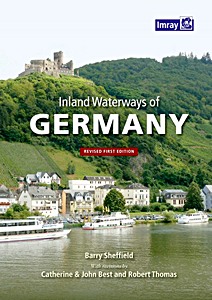
Inland Waterways of Germany (Revised First Edition)

This is the only comprehensive directory to the entire navigable German waterway system available in English. After a general introduction to the area, details of German formalities and cruising notes, each river and canal is described in detail and supported by a table of distances indicating locks, bridges, mooring places and other features.
The text is supported by small scale mapping and colour photographs.

Barry Sheffield's first edition of this book was published in 1995 shortly after the reunification of Germany. He had spent several years exploring the navigable waterways and, with the assistance of Konrad Nussbaum, the acknowledged expert on German rivers and canals, he produced this authoritative work on the subject.
Barry Sheffield died some years ago and this revised edition has been produced as a result of many contributions from users of the original book. Catherine and John Best have completely recompiled many of the original tables, brought information up to date and supplied excellent new photographs.
Robert Thomas has contributed a more general update, in particular to the introductory sections.

Autor:Barry Sheffield, Catherine Best, John Best
Presentación:183 páginas, 30 x 21.5 x 1.9 cm, tapa blanda
Ilustración:abundantemente ilustrado con fotos a color y mapas
Editor:Imray, Laurie, Norie & Wilson Ltd (GB, 2016)
Livre: Inland Waterways of Germany (Revised First Edition)

Inland Waterways of Germany (Revised First Edition)

Idioma: Inglés

Comprar en Amazon ES
Comprar en Amazon.com
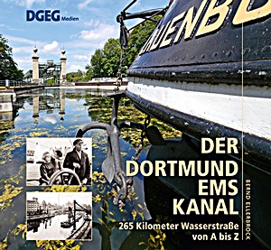
Der Dortmund-Ems-Kanal - 265 Kilometer Wasserstraße von A bis Z

Der Dortmund-Ems-Kanal ist das Mittelstück im Netz der Wasserstraßen zwischen Rhein und Elbe. Er verbindet den größten Kanalhafen Europas - Dortmund - mit Emdens Seehafen an der Nordsee, einst Deutschlands Erz- und Kohlehafen für das Ruhrgebiet. Doch "Kohle zu Berg und Erze zu Tal", das ist längst Vergangenheit. Der Kanal musste sich immer wieder neu erfinden, wurde ausgebaut, umgebaut, in neue Trassen verlegt.

Dieses Buch, das an den vorliegenden Band über den Mittellandkanal anschließt,
portraitiert den Dortmund-Ems-Kanal fakten- und facettenreich und bietet - abgerundet durch eine ausführliche Chronik - nüchterne Informationen genauso wie unterhaltsame, bisweilen überraschende Geschichten.

Autor:Bernd Ellerbrock
Presentación:276 páginas, 22.5 x 24.5 x 2.5 cm, tapa dura
Ilustración:400 fotos en b/n y color
Editor:DGEG Medien GmbH (D, 2017)
Livre: Der Dortmund-Ems-Kanal - 265 Kilometer Wasserstraße von A bis Z

Der Dortmund-Ems-Kanal - 265 Kilometer Wasserstraße von A bis Z

Idioma: Alemán

Comprar en Amazon ES
Comprar en Amazon.com
Reise entlang der Elbe - Von der Quelle bis zur Mündung

Von der Quelle in Tschechien bis zur Mündung in die Nordsee bei Cuxhaven gehört die Elbe mit 1094 Kilometern Länge zu den 200 längsten Flüssen der Erde. An ihrem Lauf liegen Burgen und Festungen, berühmte Städte wie Dresden, Magdeburg oder Hamburg sowie spektakuläre Landschaften wie das Elbsandsteingebirge.

Rund 190 Bilder zeigen die ganze Vielfalt des mächtigen Stromes, vier Specials berichten über die Tier- und Pflanzenwelt an und in der Elbe, über Brücken, Tunnel und Fähren, den Elbe-Radweg und die Elbe als Grenzfluss.

Páginas del libro Reise entlang der Elbe (1)

Autor:Mario Weigt, Beate Steger
Presentación:140 páginas, 30 x 24 cm, tapa dura
Ilustración:187 fotos a color
Editor:Stürtz Verlag (D, 2014)
Livre: Reise entlang der Elbe - Von der Quelle bis zur Mündung

Reise entlang der Elbe - Von der Quelle bis zur Mündung

Idioma: Alemán

Comprar en Amazon ES
Comprar en Amazon.com

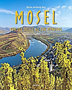
Mosel - Von der Quelle bis zur Mündung

Der antike Dichter Ausonius hat sie schon vor zweitausend Jahren in seiner "Mosella" besungen, und auch andere Literaten beeindruckte die Flusslandschaft der Mosel in der einen oder anderen Weise: Während Goethe wohl in Ehrenbreitstein zu seinem gefühlvollen "Wertherstil" gefunden hat, lästerte Tucholsky über das Kaiserdenkmal am "Deutschen Eck", das die "Ornamentmasern" habe.
Von hier unternahm Hanns-Josef Ortheil seine "Moselreise" bis nach Trier. Der literarische Salon der Sophie von La Roche war ebenso bedeutend für die Kulturgeschichte an der Mosel wie die "Lesegesellschaften" in Koblenz und Trier.

Die kleineren - und vielleicht wichtigeren - Geschichten ereigneten sich indes in den Dörfern und Städtchen zwischen der Quelle am Col de Bussang und der Mündung in den Rhein. Hier hatten die Eltern von Karl Marx ihren Weinberg an der Ruwer, und hier hat aktuell Günther Jauch den seinigen an der Saar. Die Wingerte an diesen beiden Flüssen gehören zum berühmten Weinbaugebiet Mosel, das zahlreiche renommierte Weingüter beherbergt.

Dieses Buch nimmt Sie mit auf eine Flussfahrt von der Quelle in den südlichen Vogesen durch die faszinierenden Talmäander mit den steilen Weinterrassen bis zur Mündung in den Rhein beim Deutschen Eck in Koblenz. Die städtischen Höhepunkte wie das französische Metz, das luxemburgische Schengen oder auch Trier, Traben-Trarbach und Cochem werden ausführlich gezeigt.

Autor:Brigitte Merz, Erich Spiegelhalter, Michael Kühler
Presentación:160 páginas, 30 x 24 cm, tapa dura
Ilustración:229 fotos a color
Editor:Stürtz Verlag (D, 2020)
Livre: Mosel - Von der Quelle bis zur Mündung

Mosel - Von der Quelle bis zur Mündung

Idioma: Alemán

Comprar en Amazon ES
Comprar en Amazon.com

Der Rhein - Von den Schweizer Alpen bis zum Mündungsdelta

Weltbekannte Städte wie Straßburg, Köln, Düsseldorf oder Rotterdam liegen ebenso an den Ufern des Rheins wie Konstanz am Bodensee, Schaffhausen am Rheinfall oder Speyer, Worms und Mainz mit ihren bedeutenden Dombauten.
Besonders der Wein prägt den Natur- und Kulturraum des Rheins. Neben dem Kaiserstuhl in Baden und dem Rheingau sowie Rheinhessen sind es vor allem die Steillagen des Mittelrheintals, die zum Ruhm der guten Tröpfchen beitragen.

Über 175 Bilder zeigen weltberühmte Sehenswürdigkeiten an Europas großem Strom ebenso wie eher unbekannte Kleinode.

Páginas del libro Der Rhein (1)

Autor:Brigitte Merz, Erich Spiegelhalter, Alexander Eckardt
Presentación:140 páginas, 30 x 24 cm, tapa dura
Ilustración:175 fotos a color
Editor:Stürtz Verlag (D, 2017)
Livre: Der Rhein - Von den Schweizer Alpen bis zum Mündungsdelta

Der Rhein - Von den Schweizer Alpen bis zum Mündungsdelta

Idioma: Alemán

Comprar en Amazon ES
Comprar en Amazon.com

Der Rhein - Der Mittelrhein von Mainz bis Köln

Das canyonartige Tal im Rheinischen Schiefergebirge - zwischen Bingen und Koblenz Unesco-Welterbe - wie das Neuwieder Becken und die Kölner Bucht, ergänzt um Orte, Kirchen und Burgen erschienen den Romantikern als Kunstwerk. D
ie europäische Geschichte berührte und prägte den Mittelrhein. Eindrucksvolle Bauten wie Burg Rheinfels und die Festung Ehrenbreitstein, der Mäuseturm bei Bingen und das Niederwald-Denkmal bei Rüdesheim sind prägende Landmarken.

An jeder Windung des Rheins präsentiert sich die Landschaft neu, großartige Aussichten, etwa der Blick vom Rolandsbogen über den Rhein zum sagenumwobenen Drachenfels, und malerische Orte wie Bacharach, Boppard und Oberwesel laden zum Verweilen ein. Dieser Bildband macht Lust, diese nach wie vor anziehende und begeisternde Landschaft neu zu entdecken.

Rund 180 Bilder zeigen die charakteristische Flusslandschaft in all ihren Facetten. Vier Specials begeben sich auf die Spuren der Rheinromantik, berichten über Wehrbauten, die Flussschifffahrt und weitere Verkehrswege am Rhein sowie die Wanderwege Rheinsteig und Rheinburgenweg.

Autor:Brigitte Merz, Erich Spiegelhalter, Manfred Böckling
Presentación:140 páginas, 30.5 x 24.5 x 1.5 cm, tapa dura
Ilustración:175 fotos a color
Editor:Stürtz Verlag (D, 2014)
Livre: Der Rhein - Der Mittelrhein von Mainz bis Köln

Der Rhein - Der Mittelrhein von Mainz bis Köln

Idioma: Alemán

Comprar en Amazon ES
Comprar en Amazon.com

Imray Chart C26 : IJmuiden to Die Elbe (Passage Chart)

Imray Chart C26 voor de Nederlandse en Duitse Noordzeekust tussen IJmuiden en de Elbe.

Afmetingen: 787 x 1118 mm (uitgevouwen)

Schaal: 1: 345.000 WGS 84

Inclusief volgende detailkaarten:
- IJmuiden (1: 35 000)
- Den Helder (1: 21 000)
- West-Terschelling (1: 20 000)
- Lauwersoog (1: 15 000)
- Borkum Yacht Harbour (1: 25 000)
- Norderney Approaches (1: 66 000)
- Helgoland (1: 25 000)
- Cuxhaven (1: 12 500)
- Brunsbüttel (1: 12 500).

Detalle de la carta marina Imray Chart C26: IJmuiden to Die Elbe (1)

  • Deze Imray vaarkaart is gebaseerd op officiële, actuele hydrografische opnemingen.
  • Digitaal gedrukt op Pretex papier, dat goed vouwbaar is en bestand tegen vochtige omstandigheden. Beschrijfbaar met zacht potlood en balpen.
  • Fijn raster met lengte- en breedtegraden om plotten te vergemakkelijken.
  • Gevouwen tot ca. A4 formaat, in plastic etui.
Autor:Imray
Presentación:1 páginas, 33 x 25 x 0.7 cm, mapa (doblado)
Ilustración:abundantemente ilustrado con fotos a color y mapas
Editor:Imray, Laurie, Norie & Wilson Ltd (GB, 2017)
Carta marina: Imray Chart C26 : IJmuiden to Die Elbe (Passage Chart)

Imray Chart C26 : IJmuiden to Die Elbe (Passage Chart)

Idioma: Inglés

Comprar en Amazon ES
Comprar en Amazon.com

Otros libros en esta categoría:

The Cruising Almanac 2023

The Cruising Almanac 2023 - UK and Ireland, NW Europe from Bergen to Gibraltar

Cruising Association

Inglés | tapa blanda | 480 pág. | 2022

The European Waterways : A User's Guide

The European Waterways : A User's Guide

Marian Martin

Inglés | tapa blanda | 192 pág. | 2003

The Atlantic Crossing Guide (7th edition)

The Atlantic Crossing Guide (7th edition)

RCC Pilotage Foundation, Jane Russell

Inglés | tapa dura | 304 pág. | 2017

World Cruising Destinations

World Cruising Destinations : An Inspirational Guide to All Sailing Destinations

Jimmy Cornell, Doina Cornell

Inglés | tapa blanda | 448 pág. | 2017

Ocean Passages and Landfalls

Ocean Passages and Landfalls - Cruising routes of the world

Rod Heikell, Andy O'Grady

Inglés | tapa dura | 384 pág. | 2022

< Volver arriba >


Última actualización:20-04-2024